Next Meeting: Wednesday, September 25th, 2024, CLICK HERE TO REGISTER
Socialize at 6:30, Business at 7:00, Featured Presentation at 8:00
Zoom Only
Greeting All,
Another month has gone be and there are only two UASC meetings remaining in 2016 (no December meeting). If you haven't been able to get to a meeting now is the time. The October meeting is set for this coming Wednesday, October 26th. Unfortunately I have to be in Houston this week so I won't be in attendance. In my absense our Vice President Dean Nolan will be coordinating the meeting.
This month Jim Jarecki will introduce the UASC officer election process with the election taking place during the November meeting.
Our featured speaker will be Mr. Norman Krentel, President of the Illinois Railway Museum. Mr. Krentl's presentation will concern the interurban railways of east central, lower Michigan, and their connections to the Lake Michigan steamships to Chicago, Milwaukee and beyond. This talk is based on an article Mr. Krentel published last year in the Journal of the Shoreline Historical Society [First & Fastest] last year. Thanks go to Sam Polonetzky for coordinating this months speaker.
There are a couple of shipwreck and maritime history related events coming up next month. These events are a fun way to learn about Great Lakes Shipwrecks and maritime history and they are highly recommended.
Nov. 2 - National Museum of the Great Lakes Lecture, Toledo, Ohio, http://www.inlandseas.org/event/fall-lecture-series-mcdougalls-great-lakes-whalebacks/
Nov. 4-5, Gales of November, Duluth, MN, http://www.lsmma.com/activities_events/gales_speakers.html
UASC meetings take place the last Wednesday of each month; refreshment and meet/greet start around 6:30 pm and the meetings begin at 7:00 pm. The Meetings are held at the Chicago Maritime Museum located at 1200 West 35th Street, Suite OE5010, Chicago, IL 60609. Free parking is available adjacent to the facility. Use the entrance next to the loading dock on the north side of the building (same side you will park on). The door is at ground level and the museum is on the lower level down the stairway.
I hope that you're able to attend the meeting.
Thanks,
Bob Rushman
UASC President
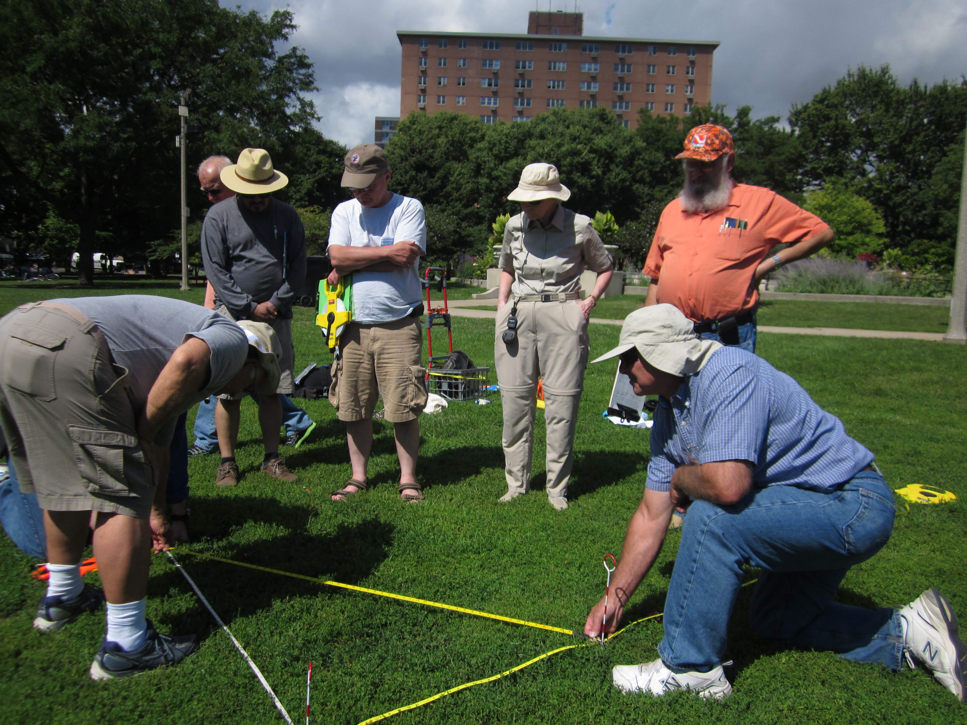
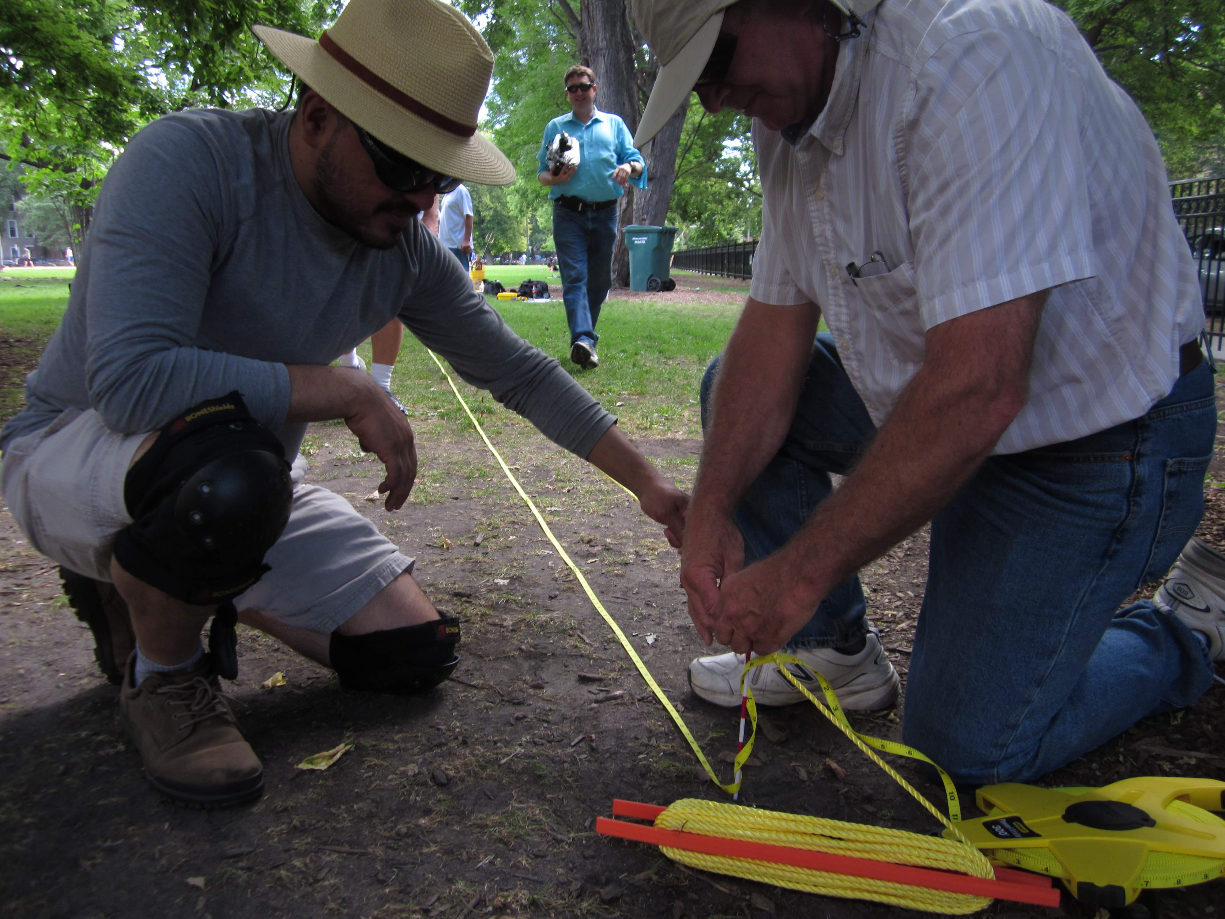
Nautical Archaeology Society (NAS) Instructor & UASC's very own, Dave Thompson, taught a NAS introductory class to some of our members earlier this month. Students spent several days in both classroom and field survey settings learning the science behind Underwater Archaeology. The class gave great insight into the fundamentals of our organization and the tools and resources available for finding, measuring and recording a wreck site.


Updated 6/1/2016
Goal: To obtain a survey drawing of a site accurate to +/-6 inches which documents the condition and position of all major features of a site at the time of the survey. As a minimum, the drawing is to be suitable for reproduction on a slate to be used by divers as an orientation guide or publication in an archaeological report.
Limitations: The following steps are subject to change and modification depending on safety and the physical characteristics of the site which include the water depth, temperature, visibility, skill of the divers, bottom terrain, available equipment and time, and site configuration. The key issues of site configuration are whether there is an intact hull or widely scattered debris and whether the wreck is three-dimensional or largely flattened on the bottom.
Steps: Documentation of a wreck site can be broken down into ten steps. All ten steps might not be performed for every survey.
1) Establish two datum points and baseline
2) Establish additional datum points and baselines
3) Place cross tapes
4) Sketch the wreck
5) Shoot a photo-mosaic
6) Shoot detail photos
7) Add 3-D detail
8) Assemble the pieces
9) Shoot video and action photos
10) Clean up the site
1. Establish two datum points and baseline. The first two datum points should be placed on fixed objects of the wreck which are not expected to move. These are typically selected at the extreme ends of the main wreckage such as the stern post and stem post. A cable lock and carabiner attached to the wreck with a numbered tag can serve as a datum pint. If a convenient attachment point is not available on the wreck, or if it is not allowed to attach tags to the wreck, a 3-foot long piece of steel electrical conduit can be driven into the lake bottom. Attach a carabiner to the conduit. Extend a fiberglass measuring tape from one datum point to the other and measure the distance between the two datum points to +/- 1 inch. Ensure that the tape is straight and level. The fiberglass tape reels are available in 100 foot lengths (cross tapes) and 300 feet (baseline). Using permanent black marker black out a one-inch section of the tape every 5 feet. These tick marks are visible in photographs. Yellow tapes are best to reduce glare if strobe is used for photos. Record the orientation of the baseline with a compass.
2. Establish additional datum points and/or baselines. Depending on the site configuration, additional datum points and additional baselines could be necessary or useful. If, for example, a second significant piece of the hull exists, two datum points and a second baseline should be established on the second piece. The distance between each of the four datum points should be accurately measured to +/- 1 inch so that the position of all points can be defined by trilateration. It can also be useful for very wide wrecks to place additional base lines along the port and starboard rails.
3. Lay cross tapes perpendicular to the baseline every 20 to 25 feet. The tapes can be laid and judged to be perpendicular by eye. Alternatively use the 3-4-5 triangle method to check that tapes are square. A tape or ruler placed 4 feet from the intersection on the baseline and 3 feet from the intersection on the cross tape should have a length of 5 feet. Lay out only enough tapes to cover the area which will be worked on during the day. After the initial layout, go back and adjust the tapes to make the grid as accurate as possible. Measure the width of the wreckage at the cross tapes. Assign section numbers to each sector of the grid. For example, from 0 to 25 feet along the baseline on the port side of the hull is P1. The starboard side should be S1.
4. Sketch the wreck. Two main methods of recording the wreck are used: A) offset method and B) drawing to scale. Assign one or two divers to each section of the wreck and as a minimum use the offset method to record the locations of structural members or objects perpendicular to the baseline and nearest cross tape. Record the dimensions of the item. If the wreck is shallow enough to allow long bottom times and the diver is skilled at drawing, use the drawing to scale method. Using Mylar graph paper, set up the drawing slates on the surface showing the baseline and cross tapes of a single section to a common scale such as 4 to 5 feet per inch. Record the objects in the section to scale on the slate.
5. Shoot a photo mosaic of the wreck. Augment or replace the sketching by taking photos along the baseline(s) and cross tapes. Always try to have a portion of baseline, cross tape or stadia bar in each photo to provide a scale reference. Maintain a constant distance between the camera and the wreckage and overlap each photo by 25 percent. Taking a photo every 5 feet along a baseline or cross-tape at the black tick marks you marked onto the tapes is a good rule of thumb. Be careful to always shoot straight down in each photo. Using a very wide-angle lens (10 to 15 mm) may be necessary due to visibility, but wide lenses produce the most curvature and edge distortion. Shooting without strobe may be the best choice for even lighting, especially if you must be at least 5 feet from the wreck. If you have the capability, shoot a custom white balance at the level of the wreck and shoot available light for best results. Take a photo of your slate (with an identifying number) at the beginning and end of each line to signal a change in direction or new line. Record the direction, sequence of photos and description of each line in a divers log for later reference.
6. Shoot detail photos. Shoot scaled detail photos of any artifacts or interesting features of the wreck. Use a stadia bar or reference frame in each photo. A yellow (metal) yard stick with alternating one-inch marks and/or 6-inch marks blacked out makes a good stadia bar. A quick reference frame can be made in the same manner with a fiberglass folding ruler with alternating inches blacked out. The folding ruler can be folded into a 6 inch, 12 inch or 18 inch reference frame. Shoot detail photos with strobe light.
7. Add 3-D detail. If the wreck sticks up above the bottom more than 5 to 10 feet, vertical data should be obtained. A single depth gauge should be used to record depths at the tops and bottoms of major portions of the hull or other significant structures. If warranted, a vertical drawing (elevation) should be obtained at one or more of the cross tapes or the baseline to document the wreck. A vertical photomosaic could be shot (camera pointed horizontally) to document the hull, boiler, engine, etc. If the wreck has multiple decks survey measurements could be made on each deck or even inside the wreck if it is safe to do so and divers have the necessary experience.
8. Assemble the pieces. Divers should review their sketches immediately after the dive to add detail, correct errors, and make all text and measurements legible while the dive is fresh in their mind. At the surface, the survey coordinator should be responsible for creating a composite drawing as individual survey dives are completed. The size of the composite should be at a scale of 4, 5 or 10 feet per inch so that the composite is less than three feet in size and can fit on a single large sheet of Mylar. Adding to the composite as the work progresses will allow the survey coordinator to determine where more information is needed.
9. Shoot video and action photos. Typically, the UASC augments the survey by shooting video and additional photos. Video can be shot looking down vertically to assist in the production of the survey. A video “fly through” should be shot to give a divers perspective of the wreck. Video and photos shot with working divers in the picture provide a frame of reference and usually a more interesting photo for presentations or a report.
10. Clean up the site. Unless you are returning the following day, it is good practice to always remove the survey tapes at the end of the dive day, particularly if other recreational divers could be visiting the wreck. Tapes left for more than a few days will not maintain their position due to surge and current and could then become an entanglement hazard. Do not damage the wreck or disturb the location of objects for the purpose of surveying! (Scraping away zebra mussels is acceptable so that measurements can be made.) Absolutely no objects should be removed from the wreck site. Leave the wreck as it was found.
How thrilling it would be to dive down and explore the mysteries of any of these sunken cities! Check out the link to read all about it and watch some videos of people doing just that! Enjoy!

Remnants of the Santa Cruz, a 15th century junk found off the coast of the Philippines. http://www.franckgoddio.org/